
RAPID DECLINE
Scientist describes impacts of climate change on the Colorado River
and its 40 million users
By Coleman Cornelius | Feb. 13, 2023 | Updated Feb. 27, 2024
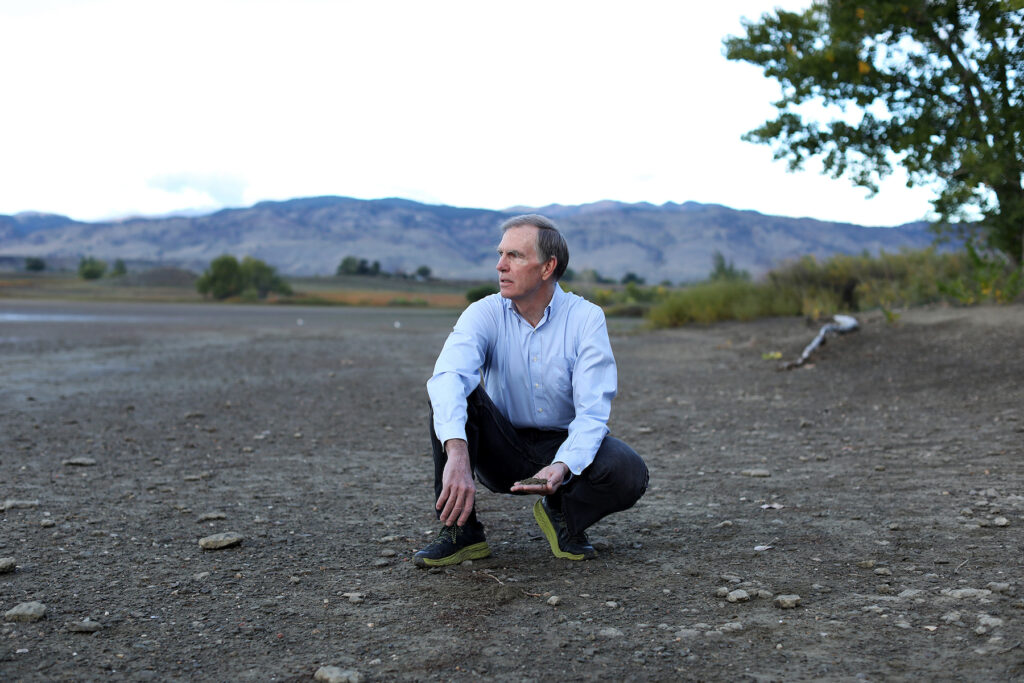
MOST PEOPLE KNOW EXACTLY where they get their water, says Brad Udall, an eminent water and climate scientist at Colorado State University.
It comes from the tap.
But, of course, the real source of our water is far more complicated. And not everyone on Colorado’s populous Front Range knows that about half the water we use for households, industry, and agriculture comes from the Colorado River Basin.
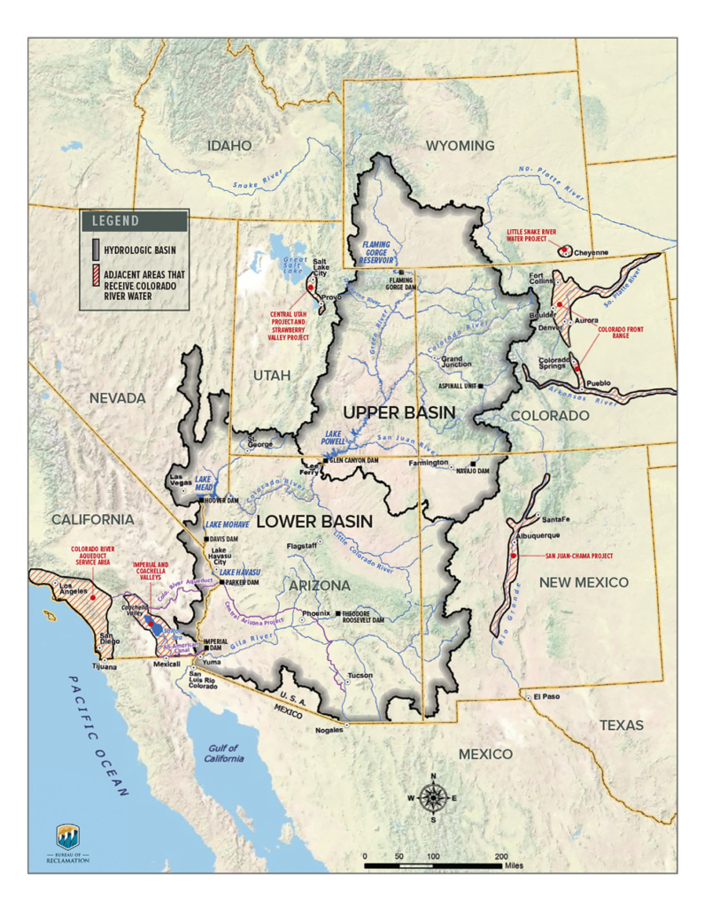
The basin begins with headwaters along the Continental Divide in Northern Colorado – think Rocky Mountain National Park. Made up of the Colorado River and its tributaries, the basin stretches across Colorado’s Western Slope, into six other Western states, and on to a portion of Mexico. It provides water for 40 million people and 5.5 million irrigated farm acres in the United States and Mexico. That includes 30 Native tribes. While several million of these thirsty folks live in Metro Denver and municipalities to the north and south, many more live in the West’s biggest cities, including Las Vegas, Los Angeles, and Phoenix.
On top of this relentless demand, the Colorado River Basin is mired in a supply crisis that is growing increasingly urgent: The region has endured serious drought for 23 years – fueled by human-caused climate change. In short, plummeting supplies, a booming population, and escalating management conflicts have combined to put the Colorado River Basin on the hot seat, with serious ramifications for Colorado and surrounding states.
The basin’s climate dynamics and management issues are the focus of Udall’s work as the senior water and climate research scientist with CSU’s Colorado Water Center. His research has become increasingly prominent as flows in the Colorado River Basin have declined and water levels in lakes Powell and Mead – the nation’s largest reservoirs and the most important in the basin – have reached critical lows during a prolonged drought.
Udall seems destined for his work: As he was growing up, his uncle, Stewart Udall, was secretary of the U.S. Department of the Interior, while his father, Mo Udall, was a congressman representing Arizona. The brothers helped develop and promote the Central Arizona Project, a vital part of the basin’s water infrastructure. Udall floated the Colorado River for the first time as a teenager and, while in college, worked as a river guide in the Grand Canyon.
In 2022, Udall delivered a number of talks coinciding with the 100th anniversary of the Colorado River Compact, the problematic framework for managing delivery of river water. The compact – in theory – apportions 7.5 million acre feet of Colorado River water per year to both the Upper and Lower basins. But the actual usage is decidedly lopsided, with the Lower Basin using more than two times that of the Upper Basin. And delivery as described in the compact is quickly becoming impossible with drought and climate change bearing down. Udall estimates that Colorado River flows have dropped by about 20 percent overall since 2000, with further declines projected due to warming and drying.
UDALL RECENTLY DISCUSSED THE ISSUES WITH STATE MAGAZINE.
Q. In Colorado, our population is nearing 6 million people, with roughly 85 percent living on the Front Range. Thanks to transmountain diversions, about half of our water here on the Front Range comes from the Colorado River Basin. Do you think people realize that?
A. They have no idea, for the most part, where their water comes from. They’re going to learn over time as these water crises become more front and center.
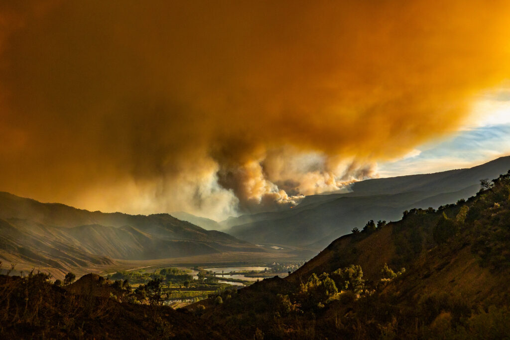
Long-term drought in the Colorado River Basin contributed to the intensity of the Grizzly Creek Fire, which scorched nearly 33,000 acres in Glenwood Canyon, Colorado, in 2020. Recent heavy snowfall in Colorado is not enough to improve long-term drought effects in the basin, Udall said.
Q. What do climate dynamics in the Colorado River Basin mean for our state and its population, particularly on the Front Range, where we see so much growth?
A. For a long time, scientists have thought Colorado River flows would decline as it warmed, and we now have proof this is happening. There are two components to this.
One is more evaporation as it warms. You have a longer growing season, it’s warmer on any given day, snow melts off earlier, and less water is left to flow into rivers and creeks because the atmosphere wants more of it. The atmosphere actually holds more moisture as it warms; there’s this bigger sponge to suck it up.
The other reason is that we’re actually going to see less precipitation in the American Southwest – and the farther south you go, the bigger the decline. That has huge implications for this state.
Of these two mechanisms, what worries me most is declining precipitation because that’s the traditional cause of drought. In the basin, we’ve measured a 23-year running precipitation average that is the lowest in recorded history. So this decline in precipitation is quite, quite worrisome.
Warming, of course, is also an issue because we think we lose somewhere between 5 percent and 10 percent of the flow of the Colorado River through enhanced evaporation for each degree Celsius of warming, or nearly 2 degrees Fahrenheit. In the Upper Basin, it’s about 3 degrees Fahrenheit warmer than it was in the 1970s, and unfortunately, the basin will continue to warm because of human-caused greenhouse gas emissions.
DID YOU KNOW?
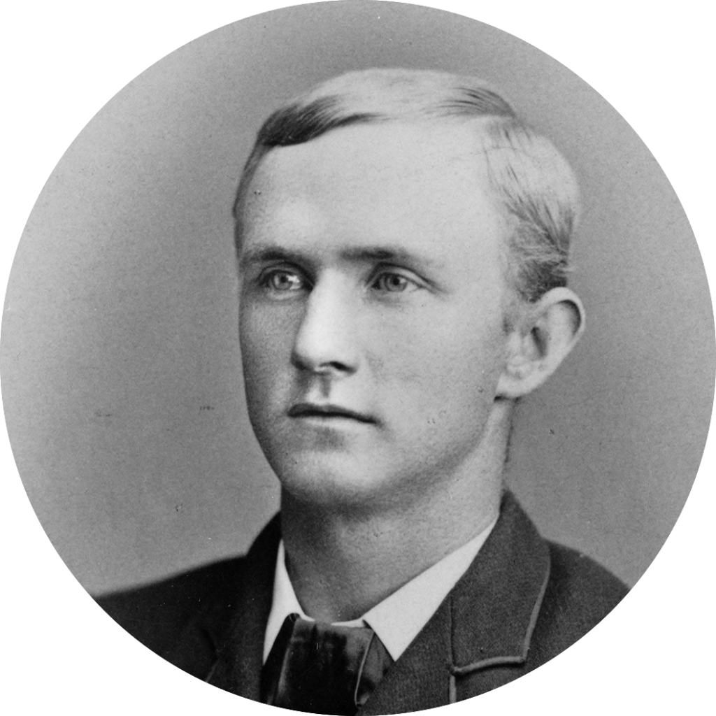
Lake Mead, the largest reservoir on the Colorado River, is named for Elwood Mead. In the 1930s, Mead was commissioner of the Bureau of Reclamation, which built Hoover Dam to form the reservoir. Earlier, Mead was an engineering and mathematics professor at Colorado Agricultural College, which became Colorado State University. He taught the nation’s very first class on irrigation engineering, helping to establish the discipline.
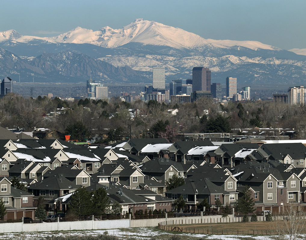
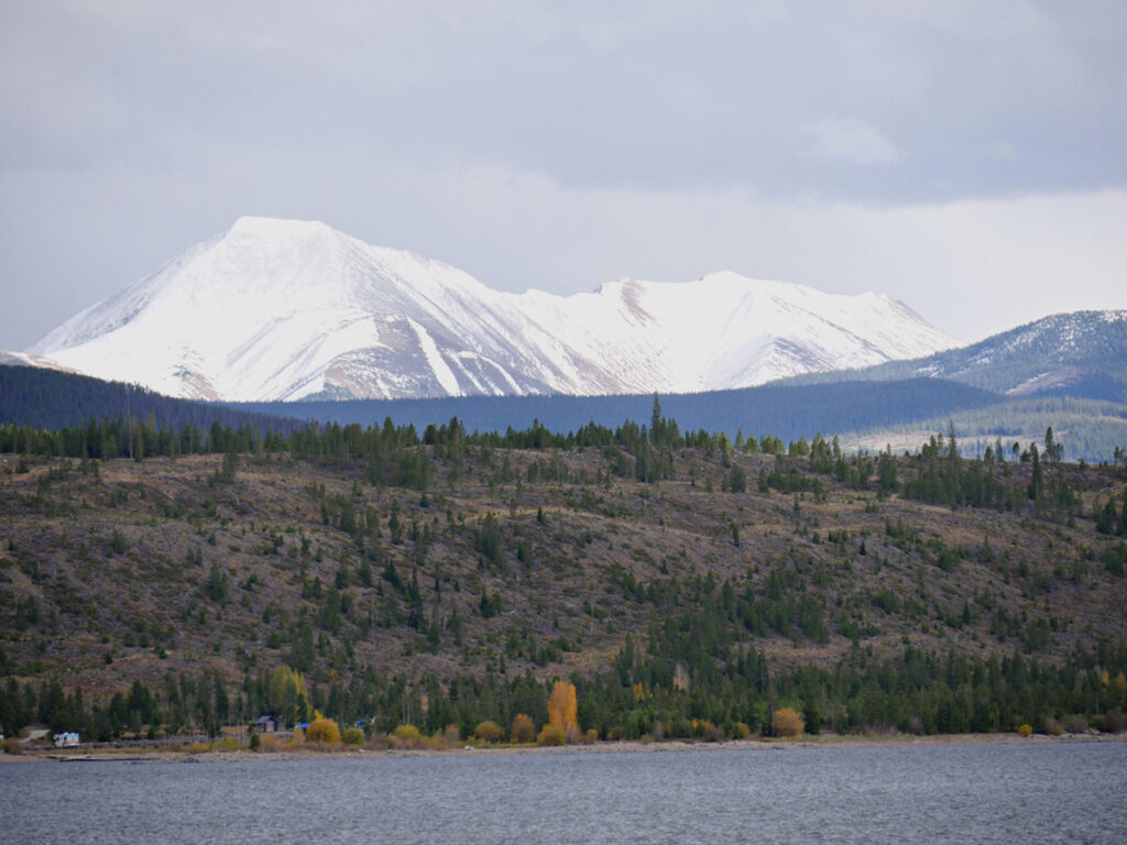
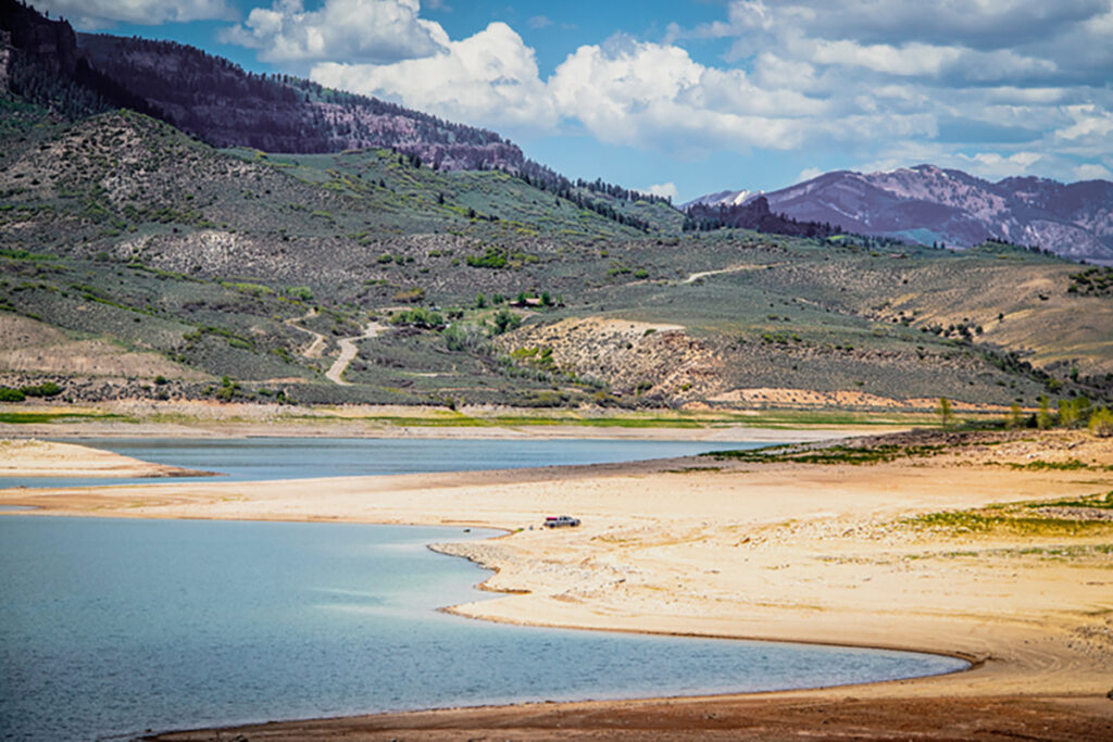
Metro Denver, left, gets half its water from the Upper Colorado River Basin, with river headwaters northwest of Longs Peak and Mount Meeker in Rocky Mountain National Park. Dillon Reservoir, off Interstate 70 in Summit County, top right, is owned by Denver Water and holds water for Metro Denver; reservoir water is transported under the Continental Divide to reach the city. Blue Mesa Reservoir, near Gunnison, Colorado, bottom right, is a key water storage facility in the Colorado River Basin and has reached dramatic lows because of drought.
Metro Denver, at top, gets half its water from the Upper Colorado River Basin, with river headwaters northwest of Longs Peak and Mount Meeker in Rocky Mountain National Park. Dillon Reservoir, off Interstate 70 in Summit County, middle, is owned by Denver Water and holds water for Metro Denver; reservoir water is transported under the Continental Divide to reach the city. Blue Mesa Reservoir, near Gunnison, Colorado, bottom, is a key water storage facility in the Colorado River Basin and has reached dramatic lows because of drought.
Q. We’re talking about the overall effects of major drought, but 2023 was a remarkably wet year for parts of the basin. In fact, lakes Powell and Mead now sit at between 30 percent to 40 percent full – an improvement of about 10 percent from their lows in 2022. How do the precipitation and snowpack of 2023 affect the outlook?
A. While 2023 was good, it wasn’t lifesaving, and it wasn’t unprecedented – 2011 had higher river flows. It has bought us some time for difficult conservation planning and agreements, but it does not fundamentally change conditions in the basin – long-term drought remains the problem. Even with these big precipitation years, we are getting less water than we would have in the 20th century because of the drying effects of climate change.
Q. Many people have referred to the 23-year drought in the Colorado River Basin as a megadrought because of the length of time it has dragged on. You have referred to it as aridification. What does that mean, and how does aridification differ from drought?
A. The symptoms of aridification include long-term warming and drying in large parts of North America, especially in the Southwest, but not exclusively. Not every year is warmer, not every year is drier, but that’s the trend, and it’s going to further reduce flows in the Colorado River through time.
This warming and drying trend causes earlier snowpack runoff, more rain, and less snow. The atmosphere wants to hold more moisture. We have reductions in river flows, drier soils, forest mortality, and more severe wildfires. There’s a whole series of these things that occur as it aridifies. None of them is good.
Droughts are temporary, while aridification is not. Aridification puts us on a path to a very different climate that will continue until we stop greenhouse gas emissions.
We've blundered our way into this water crisis because we just never had the conception or were unable to believe that these flows could decline permanently. As was often said of 9/11, we had a failure of imagination. Here we have something similar: failure to accept the science.”
— Brad Udall, senior water and climate scientist, CSU's Colorado Water Center
Q. Before the precipitation of 2023, historic lows were seen in Lake Powell and Lake Mead. That has triggered water use cutbacks in the Colorado River Basin, intense conservation planning, and alarming scenarios for water availability and hydroelectric power availability. How did these huge reservoirs get so dangerously low?
A. We’ve blundered our way into it because we just never had the conception or were unable to believe that these flows could decline permanently. As was often said of 9/11, we had a failure of imagination. Here we have something similar: failure to accept the science. People naturally want to think it’ll get better, and, unfortunately, after 23 years, anybody who thinks it’s going to get better needs to rethink that.
Lakes Powell and Mead have buffered us through imbalances over the last 23 years by releasing more water than flowed in. But the reservoirs are now less than 30 percent full – so low that the game is up very soon. Jim Lochhead, the recently retired CEO of Denver Water, had a great line at a recent symposium. He said, “We’re looking at a bank account that is at zero balance, with no line of credit.” We’ve had a line of credit with the reservoirs for decades, but that’s nearing an end.
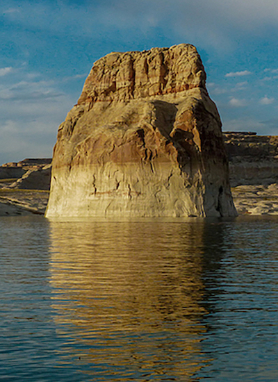
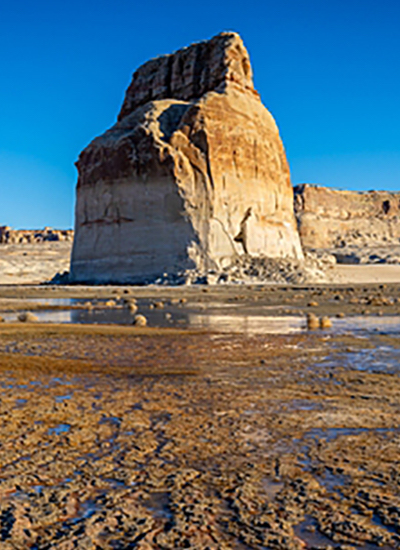
Receding waters at Lone Rock in Lake Powell illustrate the impacts of megadrought. Hydroelectric generation will be endangered if the lake continues to shrink.
Q. What is Colorado’s role in the crisis in the basin and in solutions?
A. We’re the largest user of Colorado River water in the Upper Basin states. We clearly need to conserve and use less water. Some of that is going to come out of our cities, and some of it’s going to come out of the agricultural sector because agriculture in the American West, including in Colorado, uses somewhere between 70 percent and 80 percent of water. Because of its size, more pain is going to be felt by ag; there’s just no way around that. But the cities will also need to step up, for sure.
Q. Water managers often discuss the differences in Upper Basin and Lower Basin use and responsibilities in cutbacks. In a nutshell, what are the issues at play between Upper and Lower?
A. This is a huge question. Until very recently, the Lower Basin was using 10 million acre feet of Colorado River water per year, and the Upper Basin is using about 4½ million. Despite recent Lower Basin cutbacks of about 1 million acre feet, they are still using too much water. If you use more water, you’re going to have to contribute more to solve this problem, so much of the focus is on the Lower Basin to provide solutions. And what we’re seeing is infighting in the Lower Basin about how to get cuts in place.

HOW MUCH IS AN ‘ACRE FOOT’?
1 acre foot of water is enough to cover an acre – roughly the size of a football field – to a depth of 1 foot. That’s about 326,000 gallons. The average household uses about ½ acre foot of water per year.
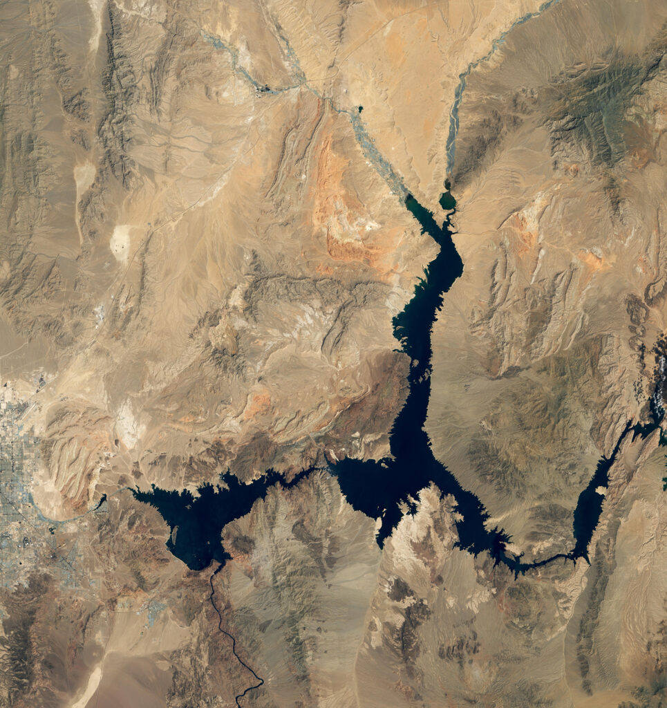
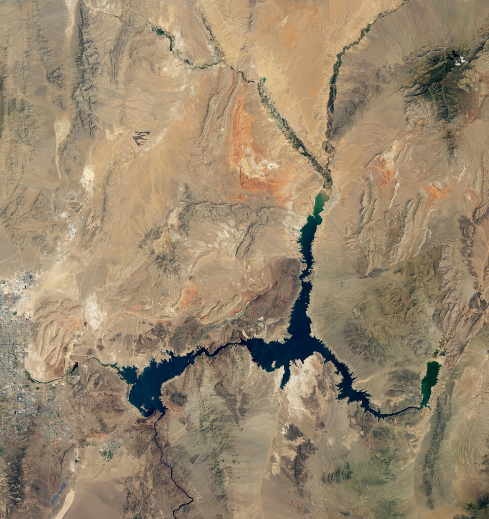
NASA satellite images show water decline in Lake Mead from 2000, at left, to 2022. The largest reservoir in the United States is now at less than 30 percent capacity. Meantime, as of early February, the seven states that depend on the Colorado River had failed to unanimously agree on water-usage cutbacks to save dwindling supplies; negotiations continue among the states and federal officials.
NASA satellite images show water decline in Lake Mead from 2000, at top, to 2022. The largest reservoir in the United States is now at less than 30 percent capacity. Meantime, as of early February, the seven states that depend on the Colorado River had failed to unanimously agree on water-usage cutbacks to save dwindling supplies; negotiations continue among the states and federal officials.
Q. The Colorado River Compact turned 100 years old in 2022. What role does the compact have in state responses to historic lows in the basin?
A. Western water law is in a period of tremendous upheaval to a new, and still very much uncertain, system. The old system was based on priority: first in time, first in right. It made sense for miners and farmers in an earlier time. It doesn’t make much sense in the 21st century because if you’re a city and you’re a junior user, you run the risk of being completely cut off. You can’t just completely cut off a city. But we spent 100 years planning around this system of prior appropriation and seniority. We’re finding there are issues we haven’t accounted for, such as protecting the reliability of infrastructure and safeguarding human health and safety that must take precedence over strict priority.
Q. It’s also interesting that the Colorado River Compact was drafted during peak water years, so people had a very unrealistic sense of what might be available in the future.
A. I hate to say this, but the history of water allocation and water projects in the American West has been defined by too much optimism, too much boosterism, too much, “Rain follows the plow.”
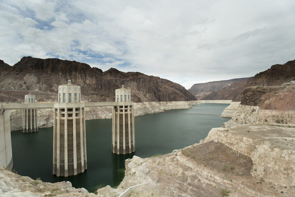
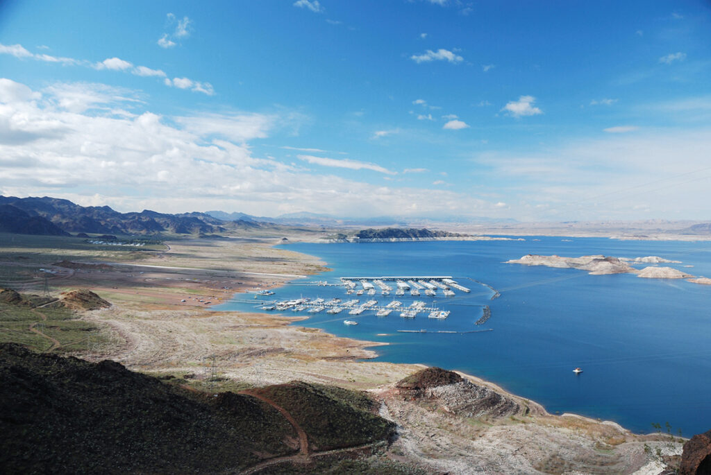
Water managers fear Lake Mead could plummet to “dead pool,” below the level needed to generate hydroelectricity at Hoover Dam and to deliver water to Nevada, Arizona, and California. Receding water has already forced extension or closure of many boat launch ramps.
Q. You recently coauthored a policy paper in the journal Science addressing what it will take to stabilize use of Colorado River water now that the effects of climate change are clear. What were some of your key recommendations – and are they achievable?
A. The saying, “Nature bats last” is a good one to keep in mind because nature is going to balance the books if we don’t. What we said in the paper is there are a variety of ways in which we could reach a balance. We set forth combinations of reductions in Lower Basin water use, plus caps on Upper Basin water use, so each side gets a penalty. These solutions will impose significant pain, but more on the Lower Basin.
Q. What happens without significant management changes?
A. The worry is that we reach dead pool in lakes Powell and Mead – when levels drop so low that water can’t flow downstream from the dam. That would mean no hydropower out of Lake Powell and, potentially, no hydropower out of Mead. It also means, more importantly, stranded water in both of these reservoirs, so we can’t get it to Lower Basin users. It’s completely untenable, and we can’t allow ourselves to go there.
Climate change is water change. If we keep heating the planet like we're doing, we're going to continue to change the water cycle in fundamental ways. So we need to get to net-zero greenhouse gas emissions as soon as we possibly can.”
— Brad Udall, senior water and climate scientist, CSU's Colorado Water Center
Q. You and others have noted that the public, as a whole, doesn’t seem to fully hear or respond to messages about climate change and these drastically dropping water supplies in the basin. How might climate scientists more successfully communicate facts to the public?
A. Nowadays, there are lots of teachable moments when it comes to climate change. It’s being able to connect the dots between floods, drought, wildfires, and things like low flows in the Colorado River Basin. I think many people get climate change. The problem is the next step: What do we do about it? In the case of water, it means cutting back – pursuing conservation and efficiency with every tool we have.
It also means keeping our eye on the big problem here, which is solving the climate crisis. Climate change is water change. If we keep heating the planet like we’re doing, we’re going to continue to change the water cycle in fundamental ways. So we need to get to net-zero greenhouse gas emissions as soon as we possibly can. Everybody – and I include water providers – needs to be shouting from the rooftops, “Hey, politicians, we’ve got a problem here. Help us solve it.”
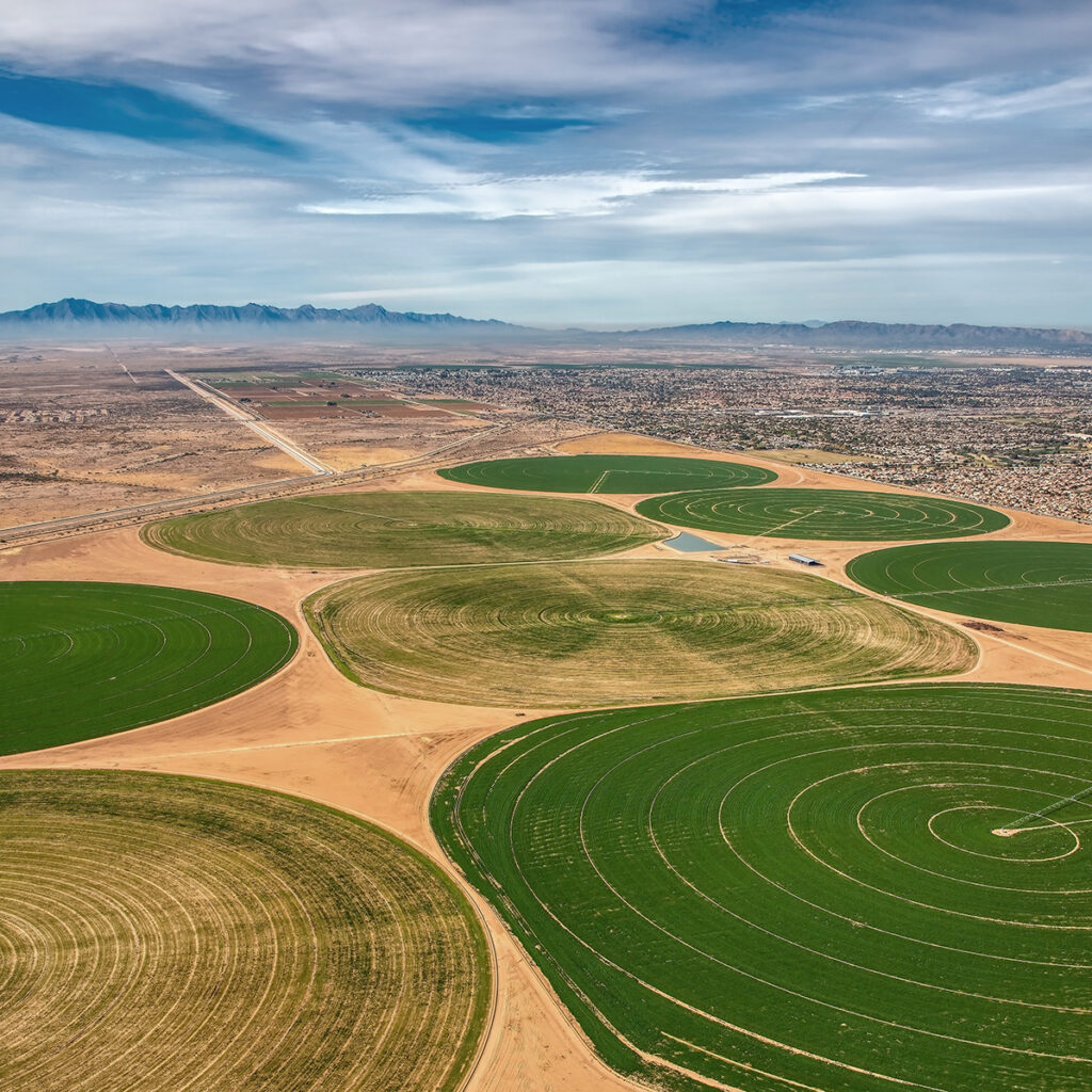
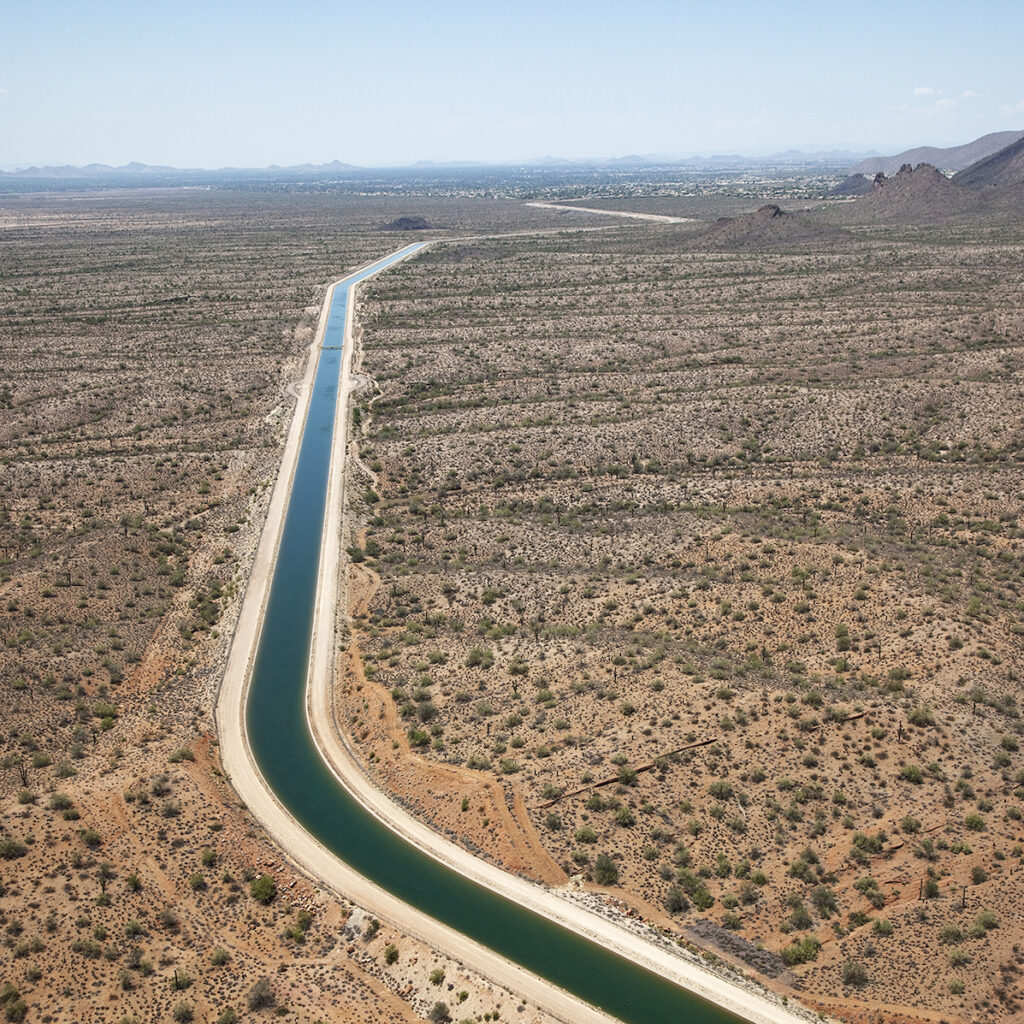
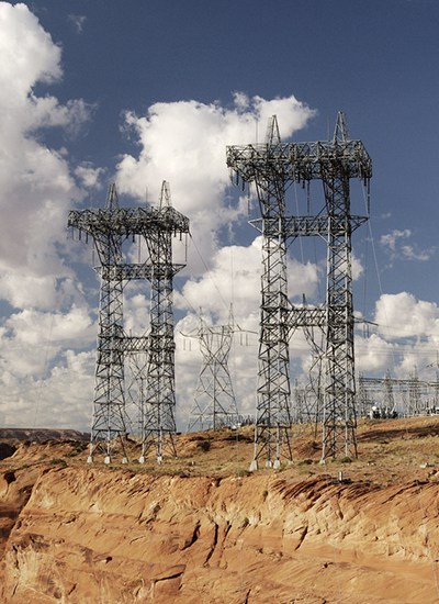
Extensive farmland receives irrigation water and 80 percent of the Arizona population receives municipal water through the Central Arizona Project, a massive distribution system in the state that Brad Udall’s father and uncle worked to establish. Accelerating evaporation in diversion systems such as this is a top concern resulting from climate change.
Q. You mentioned that, in the West, around 80 percent of our water supplies are used by agriculture to grow our food and fiber and other essential products. How is the agricultural industry participating in basin discussions? And what are some of the key ways that agriculture is pitching in?
A. I would argue the dialogue in this state is better than anywhere. The farming community is actively engaged. Nobody wants solutions imposed upon them, so I think we need to look to ag to have them tell us how to solve this. I think some permanent demand reduction is going to have to happen. It’s going to be painful, and we’re going to have to figure out ways to minimize the damage. Efficiency in agricultural water use is certainly in play, but we need to make sure it’s done effectively.
Q. Regarding municipal use, we know a majority of our household water typically goes to lawn irrigation. Do you think cash-for-grass programs, which provide incentives for homeowners to replace lawns with xeriscaping, can be effective conservation tools?
A. I think it can be. It’s a lot of work because you’ve got to replace lawns with native and low-water plantings. And you can’t let a developer come in and put in new bluegrass after you’ve ripped it out somewhere else. Another issue is that you don’t want to lose trees and tree cover, which make spaces cooler and more livable – and often rely on water used to irrigate lawns. But these programs have made a difference in places like Los Angeles and Las Vegas. Jim Lochhead has this great saying – “If grass only sees a lawnmower, it needs to go away.” Meaning, purely ornamental lawns are not sustainable.
DID YOU KNOW?
CSU Libraries holds the papers of Delph E. Carpenter, architect of the Colorado River Compact of 1922. It is the legal framework designed to apportion water from the Colorado River among seven Western states, 30 Native tribes, and Mexico. Carpenter, known as the “father of interstate river compacts,” was from Greeley and served Colorado as a lawyer, state senator, and river commissioner.
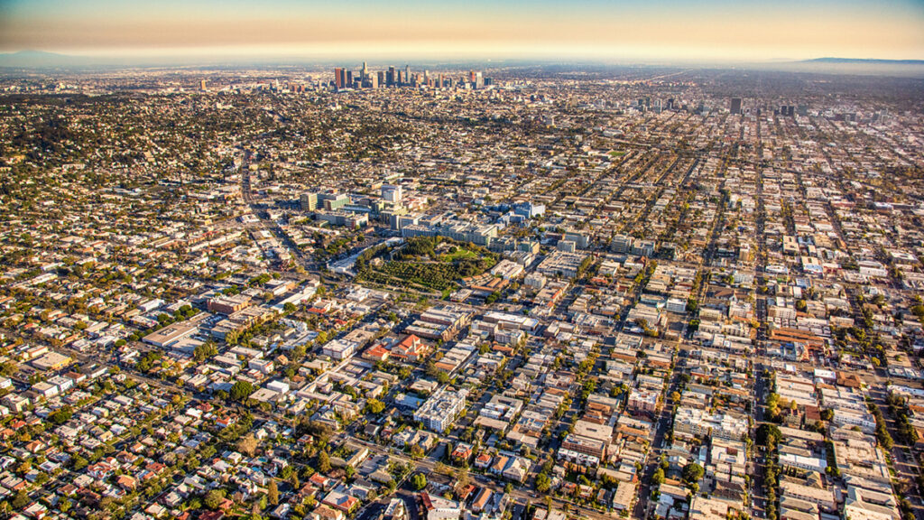
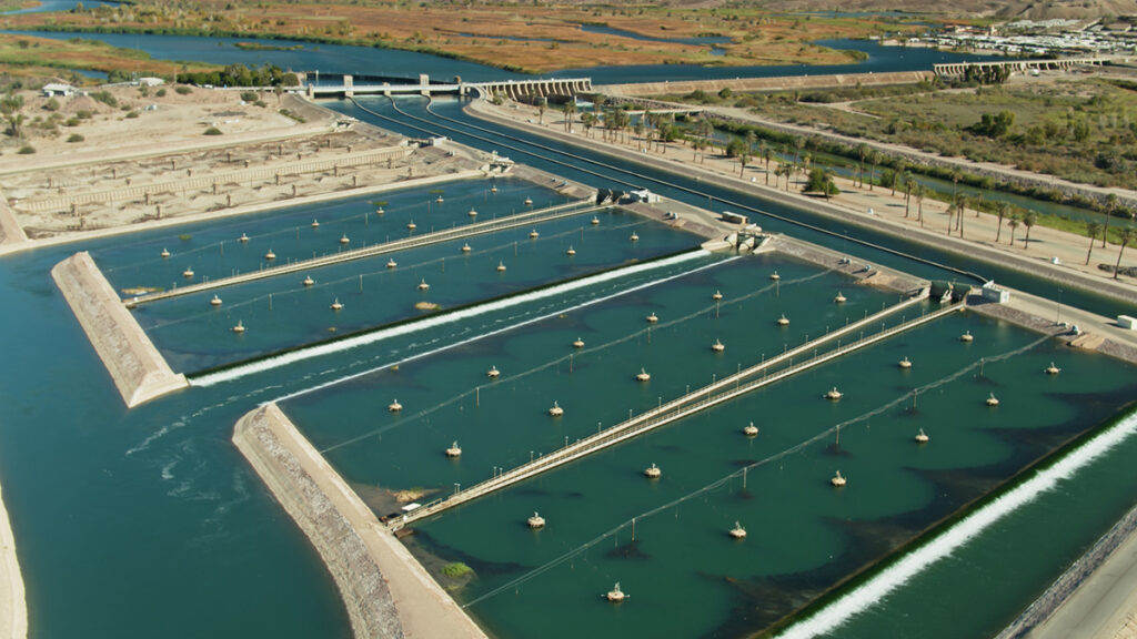
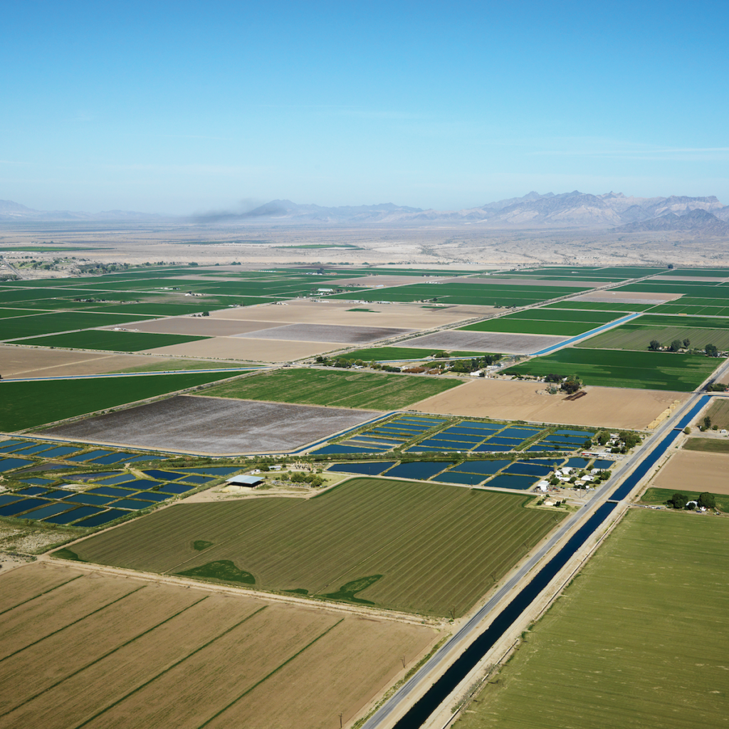
Left: Los Angeles and the Imperial Valley, an important agricultural region south of the city, rely heavily on Colorado River water and make California the largest user of seven states in the basin. Right: The Imperial Dam and Reservoir on the California-Arizona border diverts river water to irrigate California’s Imperial Valley, the most productive winter agricultural region in the United States. Among other benefits, valley agriculture supplies consumers with fresh produce in the winter.
Top: Los Angeles and the Imperial Valley, an important agricultural region south of the city, rely heavily on Colorado River water and make California the largest user of seven states in the basin. Bottom: The Imperial Dam and Reservoir on the California-Arizona border diverts river water to irrigate California’s Imperial Valley, the most productive winter agricultural region in the United States. Among other benefits, valley agriculture supplies consumers with fresh produce in the winter.
Q. Given the dire water picture in the Colorado River Basin – the Colorado River doesn’t even reach the Gulf of California anymore – what motivates you to work on climate science in this region? It can be a doomsday scenario.
A. A lot of climate scientists are more than a little depressed because they’ve been shouting for years about the need to do something, and very little has gone on. For me, I sort of revel in telling people stuff they don’t want to hear. I call myself the skunk in the room. But I think humans can demonstrate their best capabilities when their backs are up against a wall, even if it takes them a while to fully figure out they need to fight and not be passive. People in the Colorado River Basin have solved a bunch of really hard problems, and we realize we’re in this together.
‘THE WATER SITUATION IS BECOMING ACUTE’
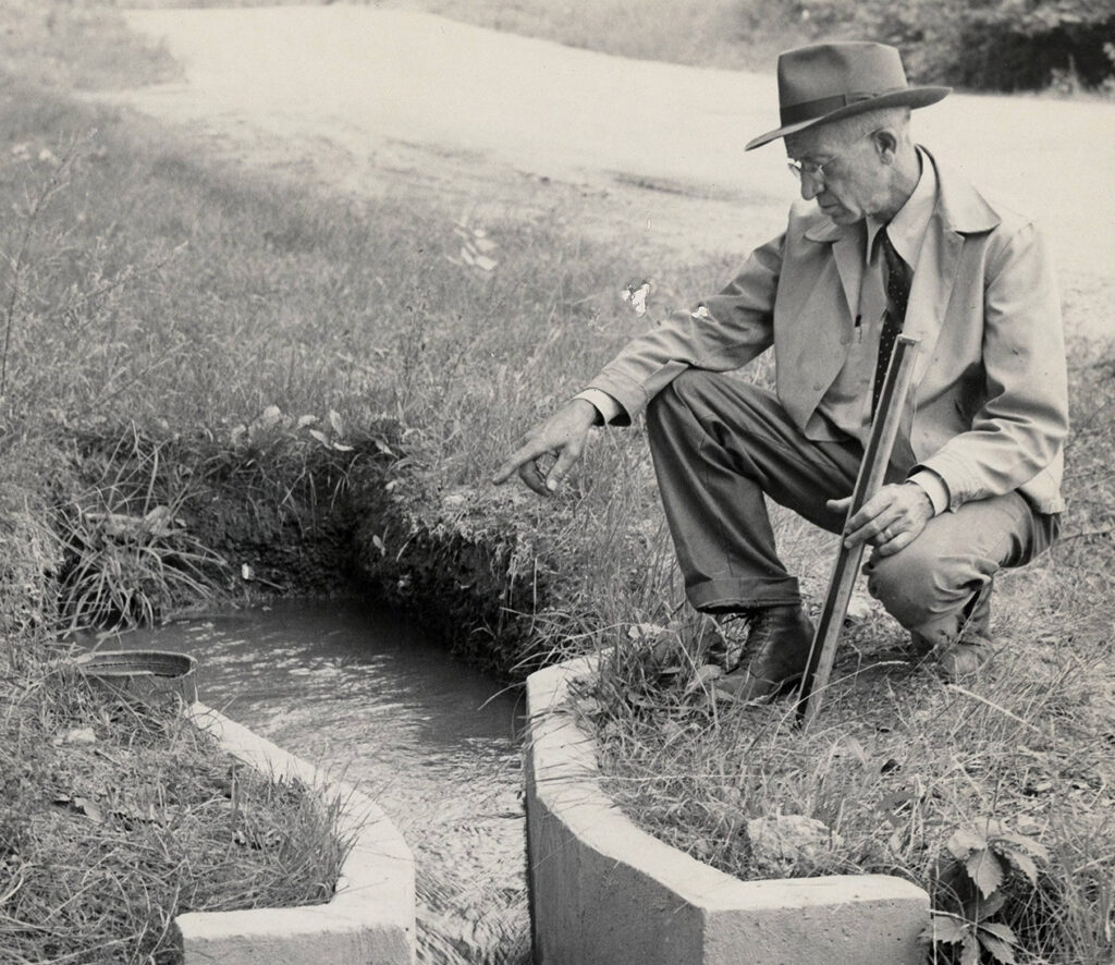
A civil engineer and hydrologist named Ralph Parshall became one of the most influential alumni and faculty members in the history of Colorado State University for inventing a device that standardized the accurate measurement of surface water flows and revolutionized irrigation.
The apparatus, developed in 1921, is called the Parshall flume. To this day, it is used around the world – in irrigation and diversion projects large and small.
In 1899, Parshall came to then-named Colorado Agricultural College as a student from a family farm near Golden. He matured into a scientist with expansive knowledge of water and climate.
During a multiyear drought in the 1950s, Parshall delivered a remarkable talk to the Fort Collins Rotary Club, during which he discussed “a change of climate and weather” and linked it to carbon dioxide emissions. The science of climate change – and even greenhouse analogies – had been described starting in the late 1800s. Yet, Parshall’s foresighted talk stands out for the threads he cohesively tied together. He discussed long-term warming and drying patterns, water scarcity, the rise of ocean temperatures and melting arctic ice, hurricane and tornado frequency, and the root cause – greenhouse gases.
Here are excerpts from his presentation in August 1956, titled “The Water Problem”:
In view of what is known at present we can conclude that mean temperatures are increasing and precipitation is decreasing. The reason for this appears to be an astronomical effect that may continue for years to come.
About the state, the water situation is becoming acute. Stream flow practically everywhere is extremely low. … Our population is growing at a steady pace which means more and dependable water supplies are needed to meet our needs. Examining the water problem we find the curve representing the population is rising and the curve showing the water supply is gradually dropping. As the years move on, these two curves get further apart, which indicates the serious situation we are approaching. People are on the move to live in Colorado, farmers are to be supplied with water, industry is expanding to use more water, and we are going downhill on water supply.
What are we going to do about this problem?
Many theories have been advanced as to the cause of the change. … Carbon dioxide gas in the atmosphere is at present a tremendous quantity, 235 billion tons. We are now adding 10 billion tons per year. Every time you drive your car around the block, you make a contribution of this gas to the atmosphere. This gas together with ozone, water vapor, and other gases at high altitude retards the radiation of heat from the earth’s surface which increases the temperature of the air somewhat in the nature of the glass roof on a greenhouse. These various natural effects have been known for a long time but since man has little or no control we can only bend our efforts in the direction of safeguarding ourselves in the best possible manner.
Photo at top: Brad Udall is pictured at Boulder Reservoir, which helps deliver water from the Upper Colorado River to the Front Range. Photo: Vance Jacobs
SHARE